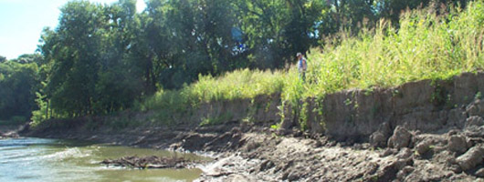
Kaskaskia River Bank Erosion
A comprehensive erosion study of a 102 mile stretch of the Kaskaskia River, between Lake Shelbyville and Lake Carlyle, was conducted by the Army Corps of Engineers for the State of Illinois. The study is being funded as a cost share from the State of Illinois C2000 program.
The report addressed the extent of bank erosion on the Kaskaskia River and major tributaries. In summary, the study has determined that the river has widened significantly over the years, with excessive bank erosion, channel sedimentation, and channel blockage from fallen trees. The increased sedimentation endangers the environmental sustainability of the river. Also, with the widening comes a reduction in the carrying capacity of the channel. The river is becoming less and less efficient in its ability to transport water during high flow events.
Restoration plan measures for improvement were developed, including dredging and dike and revetment design. For more information or photos, contact Rob Davinroy, P.E., at Robert.d.davinroy@usace.army.mil or 314.263-4717 for more information and photos.
